Geospatial Assessment and Earth Observation
Geospatial Information and Location Services
Geospatial information and Earth observation data combined with environmental, socio-economic and other statistical data provide a unique input to governments in their policy preparation, monitoring and evaluation that enable timely, more accurate and trustworthy information to be made available to inform decisions, monitor progress and assess the impact of interventions as well as for future planning. We employ cutting edge geospatial technology and analytical methods that have the potential to reduce the geospatial digital divide in Africa, and unlock the opportunities for governments, organizations and businesses to leapfrog into the future and make rapid progress

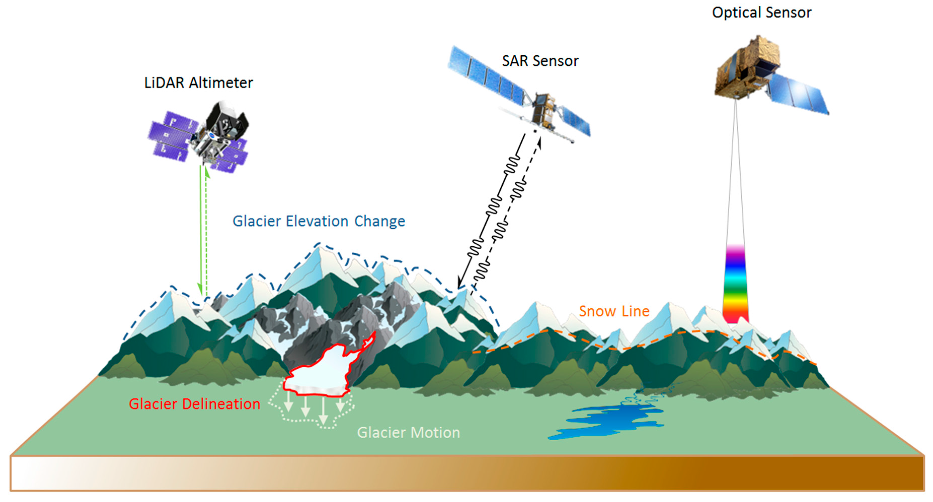
Remote Sensing and Earth observation
Currently, most of the demand for AI-powered earth observation comes from defense, government and humanitarian organizations. Profusion in the availability of EO data has led to better insights, improvement in data analytics, and service delivery, opening up a whole new set of application areas. We develop solutions for areas such as forestry, agriculture, energy, finance and insurance, cartography and critical infrastructure, among others. High-resolution and high-frequency satellite data can be used to map land use and monitor infrastructure, track agricultural development and respond quickly to natural disasters, monitor borders and coastal waters, evaluate the health of crops and natural resource production, track economic activity like transportation and factories, observe and protect the environment, and describe and predict the impact of natural phenomena or provide insights into environmental health and protection of natural habitats.
Geospatial Information Systems
A geographic information system (GIS) is a framework for gathering, managing, and analysing data. Rooted in the science of geography, GIS integrates many types of data. It analyses spatial location and organizes layers of information into visualizations using maps. With this unique capability, GIS reveals deeper insights into data, such as patterns, relationships, and situations helping users make smarter decisions. We apply Geospatial information and Earth observation data combined with environmental, socio-economic and other statistical data to provide unique inputs and solutions to our clients in their policy preparation, monitoring and evaluation in several areas: Agriculture: We develop integrative mapping and spatial solutions that help analyse and improve agriculture value chains

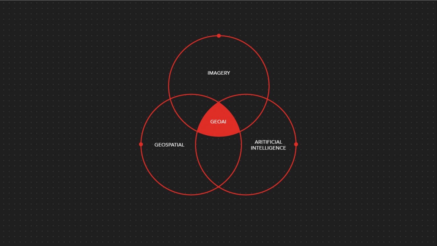
Geospatial Artificial Intelligence (GeoAI)
One of the biggest opportunities for geospatial information management in the near future is Artificial Intelligence - particularly, image analysis and information extraction. Geospatial Artificial Intelligence (GeoAI) is a sub-discipline of Artificial Intelligence that uses machine learning to extract knowledge from spatial data. With an exponentially increasing volume of remote and Internet of Things sensed data, automation is pivotal in enabling the effective processing of more and more data and achieving the goal of real-time data. Over the long-term, machine learning will be essential to deal with the growing requirements of an interconnected world. Automation is one of the initial steps in implementing Artificial Intelligence solutions. Geospatial Development/GIT (Development of GeoApps, Spatial Data Infrastructure, Web and DSS service developments, workflow automation.)